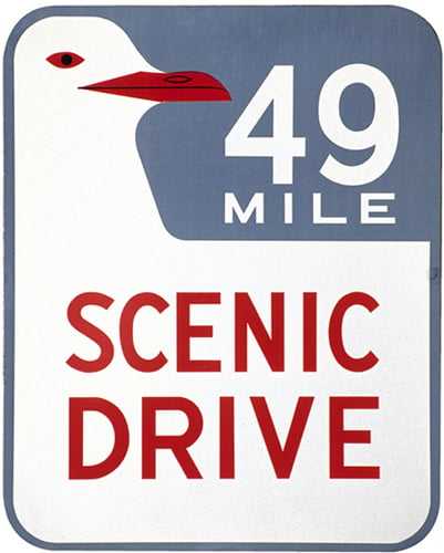
49-Mile Drive
This
all-in-one driving tour is marked with blue-and-white seagull markers,
and winds its way through the most picturesque parts of the city. It can
be challenging to follow, keeping an eye out for the markers and the
traffic at the same time, but you can get a map of the route from the
Visitor Information Center .

49-Mile Drive marker
Conzelman Road
This
road hugs the bluffs, high above the waves, on the southern edge of the
Marin Headlands. It affords some of the most famously beautiful views
of the north tower of Golden Gate Bridge, looking back at the city in
the distance. The way is punctuated with old military bunkers, since
this entire area was once given over to the army to guard the western
shores.Marin County
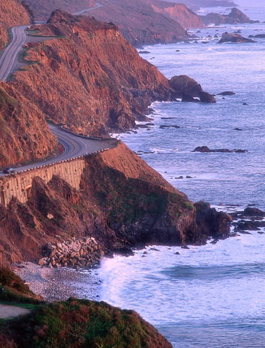
The Great Highway
Broad
and straight, this coast highway begins at Cliff House at the northern
end and eventually meets the famous Highway 1, which takes you, via
dramatic cliffs, down to Half Moon Bay, Santa Cruz, Monterey, Carmel,
Big Sur – and eventually, to Mexico.

Highway 1, from The Great Highway
Behind Stanford University
is the quiet town of Portola Valley. From here, these picturesque
switchback roads ascend to meet Skyline Drive. They are very narrow in
places, and you can’t go more than 10 mph (16 kmph), but the timeless
beauty of the Bay Area forests makes it worthwhile.